Bighorn100 was seriously hard. It's 17,000-18,000 elevation gain and the altitude (4000-9000 ft) may be less than Bear, Run Rabbit Run, Wasatch and Hardrock, yet it's the mud that slows the runner down. The 34 hour cutoff is hard for many of the runners, particularly those who live and train at low altitudes.
Check-in is Thursday afternoon before the race and includes a low-key medical check and weigh in, as well as a place to leave 3 drop bags--Dry Fork, Footbridge and Jaws, the first 2 which are accessed twice. Also Thursday evening there is a pasta supper at Ole's which includes spaghetti, salad and breadsticks in a buffet style. The food was average, but a nice gesture none-the-less.
In the morning before the race at about 9am there is a race briefing at a park in Dayton with instructions, and there were 2 shuttles (not advertised on the website) that took runners to the start line along the tongue river. We had about 1 hour to wait at the start before we could begin, so we all found shady spots to sit and talk a little.

At 11am on a sunny mid June Friday, I started at a 10 min/mile pace on a flat dirt road for 1.25 miles until we came to Tongue River TH. From that point, the pace slowed some on the gradual uphill single track trail to mile 3.5 where we crossed a bridge into Lower Sheep aid station and there we refilled bottles. From that point the pace slows considerably to the steepest section of the first half where it climbs 2400 ft in 5 miles. At one point at mile 6 or so, in light of the heavy exertion at that altitude, I decided to find a rock to sit on and have a Clif Bar while 100 runners passed me up, which was ok with me because I looked forward to a more manageable pace when I returned to the pack. It was in the upper 70s and low 80s and dry heat. After a 5 minute breather, I returned to the climb and felt much better and didn't have to stop again on that climb. At mile 8.5 we got to Upper Sheep aid station, but they were nearly out of fluids, so I couldn't fill up my bottles all of the way or get the electrolytes I needed. (Lesson 1--have more fluids for Lower Sheep to Upper Sheep next time) From that point more uphill remained until we got to Dry Fork but the scenery was amazing.
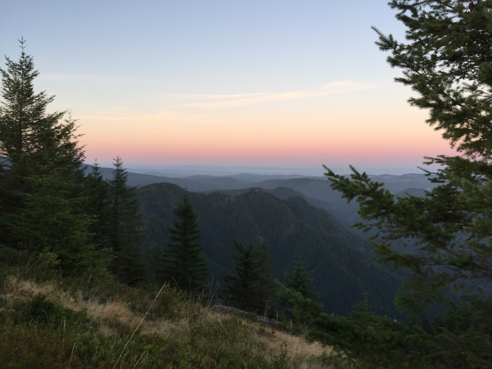
At Dry Fork at mile 13.4, it was 2:50 pm, so I was still ahead of the 4:00 cutoff. I took 10 minutes there to refill, re-sunblock and try to eat, but the PB sandwhich tasted aweful, and I couldn't finish even half a sandwich--probably due to dehydration. One volunteer said, "You better get on your way before I have to kick you out" with a smile--I took this as a friendly gesture rather than anything else. From Dry Fork to Bear Camp it was 13 miles of up and down single track at 6500 to 7500 elevation. This was a relatively fast section with lots of runnable sections but several muddy sections slowed down the pace. One of the aid stations had fresh mountain spring water from a pipe that was out of this World delicious. At Bear Camp mile 26.5, there was a gentle down hill section with the most scenic of views in a canyon flanked by rugged rock cliffs thousands of feet high, probably similar to a miniature Grand Canyon. If I would have taken any pictures, this would have been the place. From there the trail descends steeply with loose rocks, so the pace had to be gentle with 2200 feet descended in only 3.5 miles.
Footbridge is at mile 30, and is a major aid station. I was feeling tired but was doing ok. I knew I hadn't eaten or drank enough so I took 30 minutes to sit and eat, drink, and change clothes. In retrospect, I didn't eat as much as I should have (Lesson #2), but it took so much time to eat. By the time I left it was 8 pm, 1 hr 30 minutes before the cutoff. So I had saved 30 minutes since the Dry Fork, but it still took me 9 hours to go the first 30 miles. Just as I sat down, one guy relievingly anounced to the World, "I am done and am quitting here." I didn't know what was going on with him but it must not have been what he expected for this course.
As I left Footbridge, the sky was getting darker and was prepared to turn my headlamp on in a while. I passed one runner who had DNF last year at Jaws AS because he had to run along the trail that was like one long stream that year and the trail was tough to maneuver through. He was hoping to finish this year. I encouraged him and he encouraged me. I went on ahead and caught up to another vegetarian and we talked about that and foods we liked. He talked about his poor night vision but it must have not been that bad because he did not have a pacer and was doing ok. I hiked most of the uphill sections and ran the downhills. One aid station Elk Camp had chicken noodle soup, and no vegetarian soups, which was a downer, so I snacked on a few other things. This section was extremely muddy--ankle deep mud. People sometimes lose their shoes here. It is impossible to run through this deep mud. The only solution was to find the least muddy steps and hope to not get stuck. There were no mandatory stream crossings. There was always a bridge.
I arrived at Jaws AS (mile 48) at 2:30 am, and sat down. They were running out of hot food, were understaffed with volunteers for the number of runners there, and I felt basically on my own at 9000 ft in a tent with lots of people but didn't feel the greatest. I lost one of my watter bottles at this point and thankfully had a spare. At 3:00 am I left, a full 2 hours ahead of the cutoff. I was hoping to run this long 18 mile downhill section back to Footbridge, but apparently I hadn't eaten enough and my energy was not there. I ended up power hiking most of the way back to Footbridge. Running downhill at altitude is not as easy as it might seem. One still gets short of breath. On the way down the sun rose with an amazing chorus of birdsong. This time though the sunrise did not give me the burst of energy that it gave me at Badger Mtn, probably because I was only 55 miles into the 100 miles at that time, vs. 85 miles into the 100 miles at Sunrise at Badger Mtn. I was tired now and the prospect of climbing the 2200 feet up to Bear Camp from Footbridge on the approaching hot day on the loose rock climb was not appealing. At mile 62 I decided that I would make it to Footbridge at mild 66 and drop from the race there. On the way down to Footbridge, it was demoralizing to see so many 50 milers racing past me and I stopped frequently to the side of the trail to let them pass me up.
At Footbridge it was 9:15 am, 1 hour 45 minutes before the cutoff. The volunteers were telling people that they could finish even by walking it out. But at the slow walking pace that I was at by now, I was afraid I wouldn't make it to the subsequent cuttoffs which were harder and harder to meet. I ended up telling the staff I was dropping, and they told me to have a seat. I chatted with another runner who was dropping for the 2nd year in a row. I had to wait there until 11 am until a volunteer could drive us out of Footbridge. The road out was the most flooded out and bumpy road I have ever been on. It was incredible. I figured I would rather drop out by my choice than have a volunteer tell me I didn't meet the cutoff. I would rather get some rest as I was confident I could not finish by 9 pm. I was not having fun anymore. But I did have a good time for the first 55 miles, and the run was amazingly fun. I felt satisfied in the run. This was the first of 26 total sub-ultra and ultra races that I had a DNF or DNS. I learned that a DNF is not worthless--I learned a ton, and had a good workout. A DNS would have meant that I missed out on the run and would have been much worse. A finish would have been great, but that would be another day.
Anytime a runner has a DNF, there are lessons learned and things that went well.
First the details that went well:
1. Drop bags had appropriate clothing, sunscreen, lights, equipment
2. Appropriate shoes with Asics Gel Fuji-Renegade--good for mud and rocks (mud was ankle deep)
3. Holiday Inn Sheridan was quiet allowing for sleep
4. Taking downhills carefully was a good idea--no injuries or close calls
5. Oregon Coast Trail Neahkanie Mtn to Arch Cape long run was the best run I did that matched this course, except for its low altitude
6. Kept pace slow the first 30 miles which set me up to finish strong if I had hydrated and ate better
Lessons learned:
1. Have a large breakfast the morning of the race--like room service or Denny's/IHOP Friday morning for extra energy
2. Should have had more capacity for water/electrolytes (only had two 18 oz bottles) during the first 48 miles--got dehydrated which sapped my appetite along with the altitude
3. Should have eaten more food--like Clif Shots more than Clif bars because at the altitude I was breathing faster and it took so long to eat the bars.
4. Learn to only spend 1-2 minutes at each aid station (The winner did that)
5. Flying to Billings would have been better than driving because driving 1100 miles leaves mental fatigue. Mental fatigue to start out with is not helpful, because running 100 miles is mentally exhausting in its own right
6. Train more at altitude
7. Run more Elk-Kings Mtn loops in training to improve VO2max and LT, which would help with the altitude
8. Having a pacer would help out with the second half for a confidence boost
What wildlife did I see at Bighorn100? No snakes, bear, deer, mountain lions, moose, or any other large animals. I saw and heard a grouse and some smaller birds but that is about it.
Would I ever run this race again? Yes, I would because I would like to finish it next time, the course is scenic, and the altitude training is good.
What improvements in the race would I make? Have more volunteers at Jaws AS, more vegetarian options at aid stations, more fluids at Upper Sheep aid station, have a 36 hour cutoff rather than 34 hour cutoff, start at 7 or 8 am rather than 11 am. These changes alone would have taken me to the finish this year. Yet, no race design is ideal for every runner. The really talented ultrarunners are that way not only because they are in great shape, but because they learn to adapt to any situation and are prepared for what comes to them. Next time I run Bighorn100, I will know what to expect!